Illinois Association of Regional Councils
GIS Mapping

Many regional councils have in place sophisticated Geographic Information Systems (GIS) with data used for comprehensive, contingency, transportation and other planning activities.
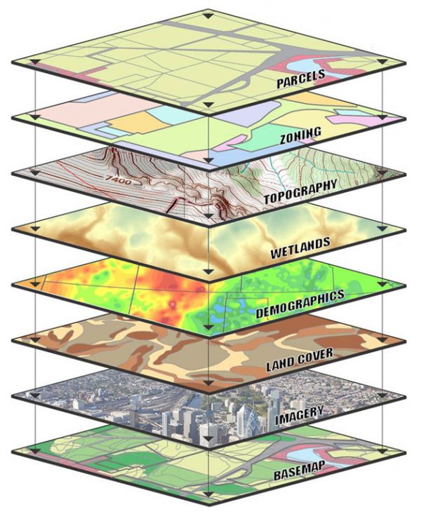
GIS has become an integral part of nearly all planning projects. The strength of GIS is its ability to create distinct map layers for different types of information, and then to combine them in any way desired or needed. A person reading a map can select the modeling of various scenarios to determine results of actions. For instance, a community involved in municipal planning may want to know how suitable different areas of the town are for development – where growth is happening. GIS can map various conditions including topography of a building site, available utilities, business retail markets, transportation hubs, road and bridge conditions, flood frequency and wetlands. Planners and local officials can also use GIS to make more informed decisions about agricultural land preservation, building permits, parcel/tax mapping, emergency dispatching (9-1-1), and zoning designations.
To learn more visit the following regional council GIS sites:
• Tri- County RPC Maps and Apps Gallery
• Springfield-Sangamon County RPC GIS Apps
• CMAP Land Use Inventories
• Coles County RP&DC GIS Portal
• Champaign County GIS Consortium
• Bi-State GIS Mapping Services
• NCICG GIS Mapping Services
• SCIRP&DC GIS Services
• Morgan County RPC GIS Services